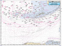
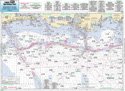
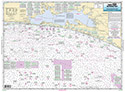
Offshore: Tampa, FL to Mississippi River
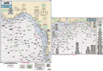
Chart #: TGM43
MSRP: $21.95 Your Price: $20.45
Click Here to
Order This Product
Offshore chart 90 to 100 miles off coast, Double sided, laminated, 19 x 26 inches. Florida, Alabama, Mississippi,& Louisiana
From Tampa Bay to the Mississippi River, LA. Includes the pipe lines, and all charts include wrecks, reefs, rigs, shoals, fishing areas, amenities and restrictions. Please refer to our inshore, nearshore and small boat/kayak charts in this area. Uses NOAA Charts 11360 & 11400
Click Here to view all
Products in our FLorida Gulf Coast Category
|
|
|
|
[ID][/ID][AID]Y[/AID][PID]p[/PID]
|
|
|
|
|
|
|
|
|
|
May Also Be Interested In |
|
|
|
| |
|
| |
| ------------------------------------------------- |
|
|
| |
| ------------------------------------------------- |
|
|
| |
| ------------------------------------------------- |
|
|
| |
| ------------------------------------------------- |
|
|
| |
| ------------------------------------------------- |
|
|
| |
| ------------------------------------------------- |
|
|
| |
|
|
|
|