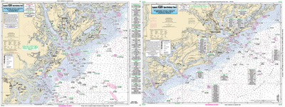
Nearshore: Off Coastal South Carolina (Charleston)

Chart #: SC29
MSRP: $21.95 Your Price: $20.45
Click Here to
Order This Product
Nearshore 20 - 30 miles off. Chart is 19 x 26 inches, double sided, and laminated. Charleston area, South Carolina.
Side A: Bull Island to Edisto Island, Side B: Edisto Island, SC to Tybee Island, GA. All charts include wrecks, reefs, shoals, fishing areas, amenities and restrictions. Please refer to our inshore, offshore and ICW booklets in this area. Uses NOAA Charts 11513 & 11521
Click Here to view all
Products in our South Carolina Category
|
|
|
|
[ID][/ID][AID]Y[/AID][PID]p[/PID]
|
|
|
|
|
|
|
|
|
|
|
|
| |
|
| |
| ------------------------------------------------- |
|
|
| |
| ------------------------------------------------- |
|
|
| |
|
|
|
|