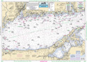
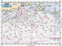
Bathymetric Eastern Long Island Sound and Nearshore CT, RI, MA
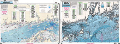
Chart #: CRM208
MSRP: $21.95 Your Price: $20.45
Click Here to
Order This Product
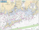
Bathymetric - color contoured by depth - Double sided, laminated, 19 x 26 inches, Nearshore, RI, CT& NY area
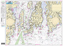
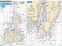
Nearshore and Inshore Bathymetric chart 10 - 20 miles off coast, Side A: Montauk, NY east to western tip of Martha's Vineyard. CT, RI & MA great detail of Mud Hole, Great Triangle, the Claw and many others, Side B: from New Haven CT, west to Fishers Island with in the Long Island Sound. Gardiner's Bay, Six mile Reef and other sites. You should use this chart in conjunction with our other NOAA based charts.
Click Here to view all
Products in our Bathymetric Charts Category
|
|
|
|
[ID][/ID][AID]Y[/AID][PID]p[/PID]
|
|
|
|
|
|
|
|
|
|
|
|
| |
|
| |
| ------------------------------------------------- |
|
|
| |
| ------------------------------------------------- |
|
|
| |
| ------------------------------------------------- |
|
|
| |
| ------------------------------------------------- |
|
|
| |
|
|
|
|