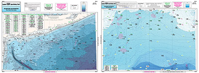
Bathymetric Nearshore Block Is. Shelf and Coastal NY and NJ

Chart #: BKL207
MSRP: $21.95 Your Price: $20.45
Click Here to
Order This Product
Bathymetric - color contoured by depth - Double sided, laminated, 19 x 26 inches, Nearshore, RI, CT, NY, NJ area
Nearshore Bathymetric chart 20 - 30 miles off coast, Side A: Block Island Shelf south of Block Island out to the tip of Atlantis Canyon covering the Dump, the Horn's, Butterfish holes and Little Fishtails, Side B: Off NY and NJ, covering from Hudson Ledge, Mud Hole, east to Amagansett, NY loads of wrecks. You should use this chart in conjunction with our other NOAA based charts.
Click Here to view all
Products in our Bathymetric Charts Category
|
|
|
|
[ID][/ID][AID]Y[/AID][PID]p[/PID]
|
|
|
|
|
|
|
|
|
|
|
|
| |
|
| |
| ------------------------------------------------- |
|
|
| |
| ------------------------------------------------- |
|
|
| |
| ------------------------------------------------- |
|
|
| |
| ------------------------------------------------- |
|
|
| |
| ------------------------------------------------- |
|
|
| |
| ------------------------------------------------- |
|
|
| |
| ------------------------------------------------- |
|
|
| |
| ------------------------------------------------- |
|
|
| |
|
|
|
|