Captain Segull's Coastline Layout
Scroll down for more Maps of the
Coastlines of the United States.
Chart page is
posted by Geographic location North to South.
Click on the chart number to see a
picture and description.
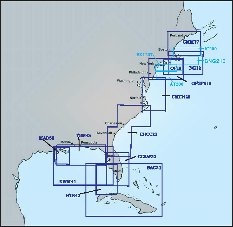
Map of coast from Maine to Florida
Offshore charts in Blue color. Bathymetric in Light Blue.
Click on the chart number to see a picture and description.
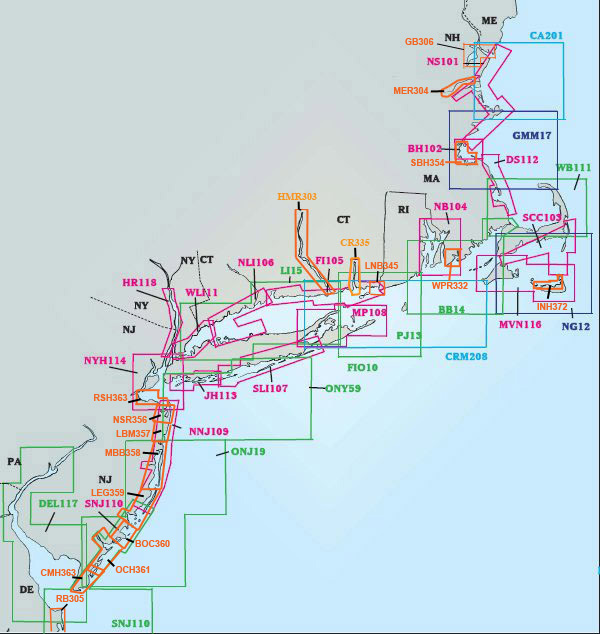
Map of NE coast from New Hampshire to Delaware
Inshore charts are in Magenta color Offshore charts in Blue color.
Bathymetric in light blue.
Small Boat/Kayak charts in Orange
Click on the chart number to see a picture and description.
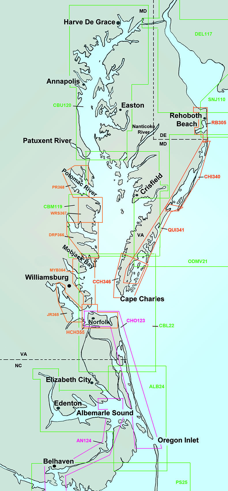
Map coast from Delaware to North Carolina
Offshore/Nearshore Coastal charts in Green color.
ICW charts are in Magenta color.
Small Boat/Kayak charts in Orange
Click on the chart number to see a picture and description.
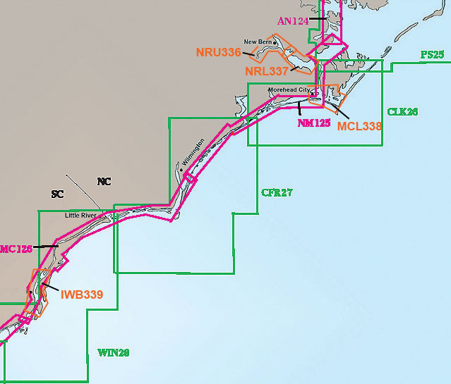
Map coast from North Carolina to South Carolina
Offshore Coastal charts in Green color.
ICW charts are in Magenta color.
Small Boat/Kayak charts in Orange
Click on the chart number to see a picture and description.
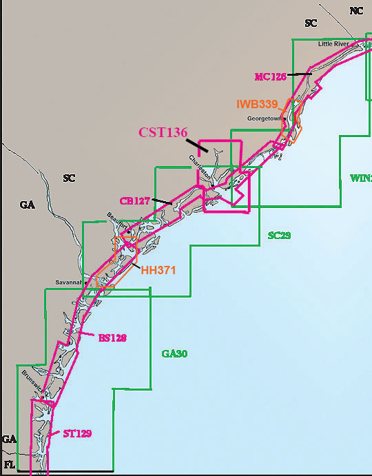
Map coast from South Carolina to Florida Border
Offshore Coastal charts in Green color.
ICW charts are in Magenta color.
Small Boat/Kayak charts in Orange
Click on the chart number to see a picture and description.
Map of coast of Florida
Offshore Coastal charts in
Green color.
ICW charts are in
Magenta color.
Small Boat/Kayak charts in
Orange
Click on the chart number to see a
picture and description.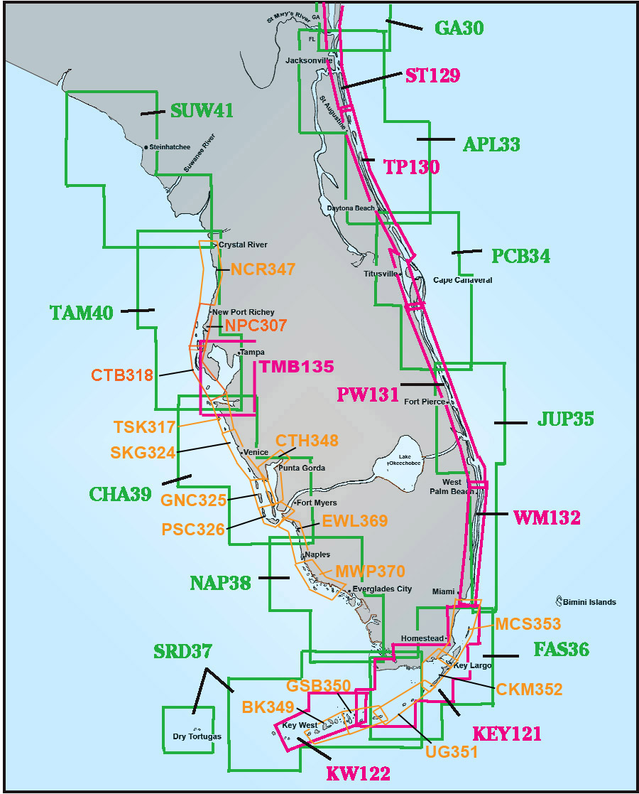
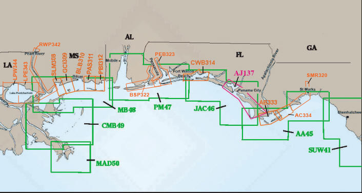
Map Coast of Panhandle to Mississippi
Offshore Coastal charts in
Green color.
Inshore charts in Magenta
color. Small Boat/Kayak charts in
Orange
Click on the chart number to see a
picture and description.
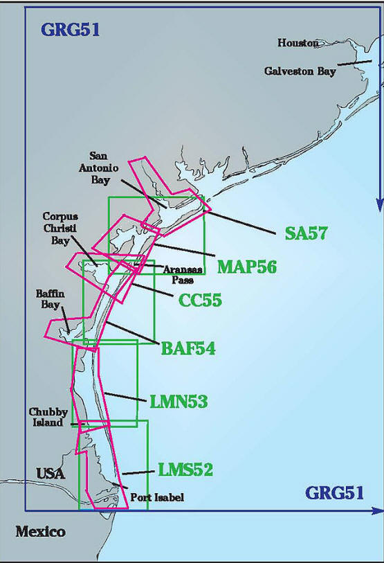
Texas Coastline
Offshore chart in Blue color.
Inshore and Off Coastal Charts in
Magenta and Green
Click on the chart number to see a picture and description.