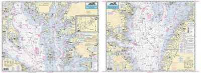
Inshore: Middle Chesapeake Bay

Chart #: CBM119
MSRP: $21.95 Your Price: $20.45
Click Here to
Order This Product
An inshore chart 1-2 miles off the coast detailing the bay. Chart is 19 x 26 inches, double sided, and laminated. Middle Chesapeake Bay
Side A: covers from Cove Point, MD to Smith Point, VA, with an continuation of Pocomoke River. Side B: from Smith Point to Wolf Trap, VA. All charts include GPS coordinates, wrecks, reefs, shoals, fishing areas, amenities and restrictions. Please refer to the upper and lower bay charts and our small boat/kayak charts.
NOAA Charts 12225 & 12230
Click Here to view all
Products in our Maryland Category
|
|
|
|
[ID][/ID][AID]Y[/AID][PID]p[/PID]
|
|
|
|
|
|
|
|
|
|
|
|
| |
|
| |
| ------------------------------------------------- |
|
|
| |
| ------------------------------------------------- |
|
|
| |
| ------------------------------------------------- |
|
|
| |
| ------------------------------------------------- |
|
|
| |
| ------------------------------------------------- |
|
|
| |
| ------------------------------------------------- |
|
|
| |
| ------------------------------------------------- |
|
|
| |
| ------------------------------------------------- |
|
|
| |
|
|
|
|