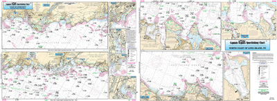
Inshore: Coast of CT, North Shore of Long Island

Chart #: NLI106
MSRP: $21.95 Your Price: $20.45
Click Here to
Order This Product
An inshore chart 1-2 miles off the coast detailing the bays. Chart is 19 x 26 inches, double sided, and laminated
Detailing the bays, covers western half of coast of Connecticut. West Haven, CT to NY border; North Coast of Long Island, NY . All charts include GPS coordinates, wrecks, reefs, shoals, fishing areas, amenities and restrictions. Also refer to our nearshore and offshore charts. Uses NOAA Chart 12364
Click Here to view all
Products in our Connecticut Category
|
|
|
|
[ID][/ID][AID]Y[/AID][PID]p[/PID]
|
|
|
|
|
|
|
|
|
|
|
|
| |
|
| |
| ------------------------------------------------- |
|
|
| |
| ------------------------------------------------- |
|
|
| |
| ------------------------------------------------- |
|
|
| |
| ------------------------------------------------- |
|
|
| |
| ------------------------------------------------- |
|
|
| |
|
|
|
|