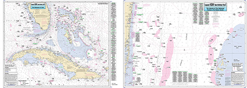
Offshore: Bahamas, Bimini Islands, and Cuba

Chart #: BAC31
MSRP: $21.95 Your Price: $20.45
Click Here to
Order This Product
Offshore chart 90 to 100 miles off coast, Double sided, laminated, 19 x 26 inches. Florida, Bahamas, & Cuba
Side A: the Islands of the Bahamas and Cuba, north to Indian River, FL, side B: is from Florida to the Bimini Islands, north to Hillsboro Inlet, south the Soldier Key, to the Great Bahama Bank. All charts include GPS coordinates, wrecks, reefs, shoals, fishing areas, amenities and restrictions.
Click Here to view all
Products in our Florida Atlantic Category
|
|
|
|
[ID][/ID][AID]Y[/AID][PID]p[/PID]
|
|
|
|
|
|
|
|
|
|
May Also Be Interested In |
|
|
|
| |
|
| |
| ------------------------------------------------- |
|
|
| |
| ------------------------------------------------- |
|
|
| |
|
|
|
|