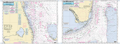
Offshore: Cape Canaveral to Key West, FL

Chart #: CCKW32
MSRP: $21.95 Your Price: $20.45
Click Here to
Order This Product
Offshore chart 90 to 100 miles off coast, Double sided, laminated, 19 x 26 inches. Florida
Side A: from just north of Cape Canaveral to Boca Raton, FL east to Southwest Point on the Grand Bahama Island. Side B: from Boca Raton to Key West, south to Dog Rocks east to Great Bahama Bank. Help with fishing locations from George Poveromo All charts include wrecks, reefs, shoals, fishing areas, amenities and restrictions. Please refer to our inshore, nearshore, offshore and ICW booklets in this area.Uses NOAA Chart 11460
Click Here to view all
Products in our Florida Atlantic Category
|
|
|
|
[ID][/ID][AID]Y[/AID][PID]p[/PID]
|
|
|
|
|
|
|
|
|
|
May Also Be Interested In |
|
|
|
| |
|
| |
| ------------------------------------------------- |
|
|
| |
| ------------------------------------------------- |
|
|
| |
| ------------------------------------------------- |
|
|
| |
| ------------------------------------------------- |
|
|
| |
| ------------------------------------------------- |
|
|
| |
| ------------------------------------------------- |
|
|
| |
|
|
|
|