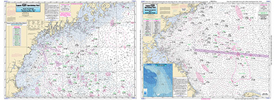
Offshore: Gulf of Maine, Massachusetts Bay

Chart #: GMM17
MSRP: $21.95 Your Price: $20.45
Click Here to
Order This Product
Offshore chart off 90 to 100 miles off coast, double sided, laminated, 19 x 26 inches, Maine, New Hampshire, and Massachusetts,
Offshore chart, Side A, the Gulf of Maine from Penobscot Bay to Boston, Massachusetts Bay, includes an inset of Portland Harbor, ME. Side B, Massachusetts Bay, Boston south to Provincetown and Duxbury, MA includes a bathymetric inset of Stellwagen Bank. Please refer to our inshore, nearshore, offshore, bathymetric and small boat/kayak charts in this area. All charts include GPS coordinates, wrecks, reefs, shoals, fishing areas, amenities and restrictions. Uses NOAA Charts 13260 & 13267
Click Here to view all
Products in our Maine Category
|
|
|
|
[ID][/ID][AID]Y[/AID][PID]p[/PID]
|
|
|
|
|
|
|
|
|
|
May Also Be Interested In |
|
|
|
| |
|
| |
| ------------------------------------------------- |
|
|
| |
| ------------------------------------------------- |
|
|
| |
| ------------------------------------------------- |
|
|
| |
| ------------------------------------------------- |
|
|
| |
| ------------------------------------------------- |
|
|
| |
| ------------------------------------------------- |
|
|
| |
| ------------------------------------------------- |
|
|
| |
| ------------------------------------------------- |
|
|
| |
| ------------------------------------------------- |
|
|
| |
| ------------------------------------------------- |
|
|
| |
|
|
|
|